
Our software is software ‘Made in Germany’
“Software ‘Made in Germany’ does not just mean meeting the highest standards in terms of quality, accuracy and security during our development process. It especially means that our products are tailored directly to the needs and requirements of our customers in Germany and Europe.”
Claus Hofmann, CEO of Disy
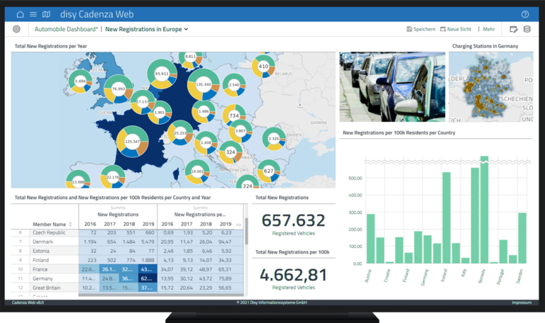
disy Cadenza
Overview. All over. Over all.
disy Cadenza uniquely unites data analytics, reporting and GIS in one product. Whether from the GIS server, special applications or from Excel spreadsheets: Analyze your data with drag-and-drop detail-rich maps, dynamic charts, and easy-to-read tables. With disy Cadenza you have a powerful software that supports you with comprehensive features for visual data analysis, organization-wide reporting and geo analytics.

GIS 2go –
GIS Cloud for Mobile GIS
GIS 2go is the easiest way to synchronise your own maps and spatial data between your desktop GIS and the GIS app disy Cadenza Mobile – via cloud. All you need is a GIS 2go account. The synchronisation works for disy Cadenza Desktop and ArcGIS for Desktop. Even when you are on the go with your smartphone or tablet, edited geometries, attributes or created graphic notes and media can be imported back to your desktop GIS using GIS 2go.